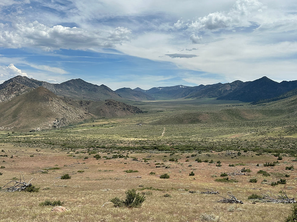
Slinkard Valley Road...from a distance.
- Jason Sheck
- Jun 8, 2024
- 4 min read
Bri and I had the privilege of flying to MN in early June to attend my Grandma Lois' 90th birthday party. There were a lot of us gathered at Aunt Kristin's house and I think Grandma was able to get the picture she was hoping for. I flew back to NV the following day, but Bri stayed longer with her family in WI. When Bri's in WI visiting family for a couple weeks, I try to find a Jeep route worth taking and hit the road. When it's just me, I try to pick a route that I suspect Bri wouldn't feel bad missing. So, I set my sights on Slinkard Valley Road. I've seen it on many maps and driven by it crossing over Monitor Pass numerous times. It's a two track gravel road through an expansive and beautiful valley in the Eastern Sierra. To get there, I made my way through Carson City, NV, to Minden, NV, and then on to Markleeville, CA. Just south of Markleeville a few miles I turned on Monitor Pass Road and headed east. To get to Slinkard Valley from the Markleeville, you have travel over nearly all of Monitor Pass and head toward the Topaz Lake, NV area. I eventually turned off the pavement and started down the two track. It wasn't but 5 minutes before I came to a gate marking the edge of a CA-state wildlife area. That's where my 1/4 mile trip on Slinkard Valley Road ended. Bri would have been thrilled with this outing. Instead of giving up, I made my way out to US Hwy 395 and travelled to the very south end of Slinkard Valley. I took Mill Road and Golden Gate Road into the valley, which eventually started climbing dramatically and steeply. As I climbed in elevation I started to accept that I probably wasn't going to be able to drive through the valley since I would be 1000' above it in a matter of minutes. That actually wasn't the problem, though. When I got to Slinkard Valley Road there was another gate! So my options were turn back, or continue up Golden Gate Road to see where it went, which ended up having great views of what I believe are the Sweetwater Mountains. It was fun to explore the Little Antelope Trailhead area at the end of the road, but I soon headed back out of the mountains and started home. The day was not a total loss, however, because I did get to stop at Bri and my favorite BBQ place, Mountain View BBQ in Walker, CA.
What did I learn?
Gates are no fun. I've gotten used to the seasonal closures of forest roads, and the restrictions on travel in wilderness areas, but there are a lot more categories of public land that have travel restrictions. In the case of Slinkard Valley Road, there was no easy way to find out if the gates were open or closed, so I had to improvise once I realized my planned route wouldn't work.
The view from the east end of Monitor Pass Road (CA Hwy 89, obviously) as you start descending into the Slinkard Valley area. I am looking south.

Every time I've gone over Monitor Pass Road and looked into the Slinkard Valley area, I've been been draw to it. The gravel road seemed to go on forever in the maps I reviewed, but you already know how that turned out.

The gate on the north end of the wildlife area roughly a half mile from Monitor Pass Road. I appreciate the spray paint stencil work! #approved

The remnants of past cattle operations are a relatively common sight in the Eastern Sierra. This loading chute was very well kept, and without knowing a lot about raising cattle, it seemed like it could still be in operation. There were no cattle around, however, or even tracks or cowpies.

Turning south on US Hwy 395 and headed for the other end of the Slinkard Valley area.

I left US Hwy 395 on Mill Canyon Road just north of Walker, CA. It wasn't long before I was greeted with a more official looking sign for the wildlife are.

A couple photos from the Little Antelope Trailhead area near the top of Golden Gate Road. I never got close enough to get a good picture, but there was a remote pack station up there for an outfitter, with several horses in the corral. Maybe you can see them in the third picture below?


The gate on the south end of the wildlife area. No cans of spray paint used here, however. The trees in the background are burnt.

One of the two places on Golden Gate Road where spring runoff was still crossing over the road surface. Finally felt like I was on a Jeep outing (sarcasm)!

This photo was taken down in the valley where Golden Gate Road starts to climb up toward the Little Antelope Trailhead. The area burned somewhat recently and the thistle is coming back with a vengeance, but the white flowers across the whole valley was a nice sight. Slinkard Fire of 2017.

Comments